Our experimental and theoretical work is dedicated to studies of aerosols, clouds, water vapour and their interactions using measurements from our ground-based long-term stations (Athens, PANGEA-Antikythera, Finokalia), dedicated experimental campaigns, and long-lived space borne sensors.
Key topics of our research are:
- The investigation of the processes that determine the life cycle of dust and its interactions with clouds and radiation.
- The development of new lidar instruments for dedicated studies (e.g. new polarimetric observations, evaluation of space borne lidar missions).
- The investigation of key atmospheric parameters (e.g. optical and physical properties of aerosols, clouds, water vapor, temperature, wind) above the Mediterranean.
- The 24/7 monitoring of the atmosphere, from the ground up to the stratosphere, supporting governmental and European infrastructures regulating aviation and air quality hazards (e.g. volcano eruptions, fires).
 Ground Based Remote Sensing
 Numerical Modeling
In ReACT we work on numerical model research and development, focusing on the representation of atmospheric dynamics and processes at various scales. Areas of research include:
- Aerosol interactions and feedbacks in the atmosphere (direct, semi-direct and indirect effects).
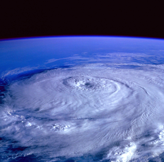
- Severe atmospheric phenomena (e.g. hurricanes, floods, duststorms, volcanic eruptions).
- Air pollution, dispersion modeling (e.g. dust, smoke, volcanic ash).
- Climate change (e.g. climatic indexes, climate scenarios).
- Data assimilation of in-situ and remote sensing data (e.g. weather radar, satellite data, radiosondes).
- Nowcasting.
- Stratosphere-troposphere interactions and modelling natural climate variability.
Operational numerical support is also provided in the framework of several European and National projects (ASKOS, CalVal, NEWTON, PANACEA e.t.c.) and modeling services are available in both the public and private sector (companies, prefectures e.t.c). Atmospheric modeling research and applications in ReACT is facilitated through a number of numerical tools such as WRF (ARW, Chem, NMM, Hydro), DREAM, FLEXPART, HYSPLIT and CR-SIM.
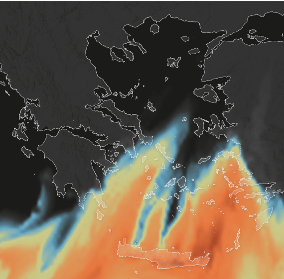
Contemporary satellite instruments, providing accurate long-term observations at global scale, consist a fundamental tool in aerosol research. Relied on different remote sensing techniques, spaceborne sensors provide information about suspended particles’ load and nature, which are both highly variable in spatial and temporal terms. Our team has vast experience on the implementation of active and passive aerosol retrievals, acquired from lidars (e.g., CALIOP, CATS) and spectroradiometers (e.g., MODIS), in a wide range of scientific tasks. The in-house developed ESA-LIVAS database, in which a global 4D depiction of aerosols and clouds has been realized through the utilization of CALIOP vertically resolved observations, consists the flagship of the satellite component of the ReACT group. Advanced techniques, applied and tested at the ground, have been adopted in spaceborne observations making feasible a global view of fine/coarse dust aerosols and dust-related CCN/IN concentrations. Moreover, a global fine resolution dust optical depth dataset has been developed via the exploitation of MODIS and CALIOP data, whereas any possible multi-sensor synergy is considered aiming at optimizing aerosol loads’ description and characterization. One of the priorities of our team is the participation in the Cal/Val activities of ongoing (AEOLUS) and forthcoming (EarthCARE) satellite missions of the European Space Agency (ESA). Satellite observations are also analyzed for the investigation of outstanding cases (e.g., dust outbreaks, smoke transport, volcanic eruptions) as well as for the evaluation of numerical simulation aerosol outputs. Finally, in collaboration with modelling groups, satellite data are ingested in data assimilation schemes towards improving dust forecasting and monitoring.
 Satellite Remote Sensing
 Scattering and Radiative Transfer
Scattering databases
The remote sensing work of ReACT involves the utilization of advanced scattering databases (e.g. Dubovik et al., 2006; Gasteiger and Wiegner, 2018).
Our research interests focus mainly on the scattering properties of dust particles, since currently there is no complete solution for calculating the scattering properties of the whole range of dust sizes, shapes and refractive indices. For this reason, the group is developing a new dust scattering database (Tsekeri et al., 2019) that takes into account realistic-shaped dust particles and a size range that includes most of the coarse mode of dust. In particular, we have used the irregular shapes of Gasteiger et al. (2011), a size range of particle radii of 0.001-5 μm for Visible light applications or 0.002-10 μm for NIR light applications, and four refractive indices with values of 1.48-1.6+i0-0.002. The scattering calculations were performed with the Amsterdam Discrete Dipole Approximation (ADDA) (Yurkin and Hoekstra, 2011) using High Performance Computing (HPC) systems.
Radiative transfer
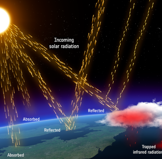
The radiative transfer work of ReACT focuses on determining the radiative effects of mineral dust in the atmosphere by probing more realistic microphysical properties in terms of grain sizes and shapes, appropriate scattering calculations and thus more accurate description of the dust optical properties. For the radiative transfer calculations we utilize advanced radiative transfer schemes, as the MYSTIC solver of libRadtran (Emde and Mayer, 2007; Mayer 2009, Mayer et al., 2010).
Our recent work focuses on the quantification of the effect of the large sizes of dust particles on cooling or warming the Earth’s atmosphere.
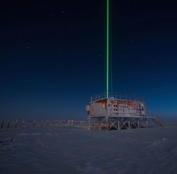
High Power UV Lidar
Developed by the National Observatory of Athens (NOA) and Raymetrics S.A., the High Power UV Lidar will be installed at the PANhellenic GEophysical observatory of Antikythera (PANGEA) in 2021. It features a high-power polarized laser (355nm), two telescopes for near and far-field measurements, and is optimized for day and night operation. The lidar will measure temperature, water vapor, and aerosol properties, including extinction coefficients, backscatter, and depolarization ratios, with high spatio-temporal resolution. It will also include a multispectral detector for fluorescence spectra and Raman scattering measurements, targeting gases like O₂ and CH₄, and detecting biogenic particles such as pollen, viruses, and bacteria.
EVE: Enhancing ESA Products
EVE, a depolarization lidar system by Raymetrics S.A., NOA, and LMU Munich, supports the ESA-Aeolus mission with mobile, high-precision aerosol measurements. Operating at 355nm, it uses dual lasers and polarization-sensitive detectors to provide reference measurements. Upgradable to multi-wavelength capability, EVE also supports EarthCARE satellite calibration. It will be deployed in the ASKOS campaign, with publications on its initial tests underway.
Aerosol Species Separation Algorithm (ASSA)
ASSA, based on Siomos et al. (2020, 2021), uses multi-spectral Raman lidar data to separate aerosol species by simulating backscatter and depolarization profiles from aerosol mixtures in the OPAC database. It matches measured lidar and radiometric data to determine the best aerosol mixture. This flexible approach supports systems operating in UV/VIS/IR and incorporates hygroscopic growth effects.

 Atmospheric Remote Sensors
 Climate Services
The recent IPCC report highlights the urgent need for collective action to limit global warming. Exceeding 2°C will harm human health, disrupt food and water supplies, damage infrastructure, and cause annual economic losses of 0.2–2% of GDP.
We provide customized climate tools to support resilience and adaptation. Our services include:
- Analysis of historical and projected climate change,
- Seasonal outlooks for sectors like tourism,
- Decadal projections based on socioeconomic pathways.
The PANGEA Observatory at Antikythera serves as our hub for monitoring and quality assurance. Using Copernicus (C3S) seasonal predictions, downscaling, CMIP6, CORDEX, and WRF data, we deliver actionable insights for mitigation, adaptation, and strategic planning.
Services
- Ready to use climate projections
- Ready to use downscaled seasonal outlooks
- On demand high-resolution (up to 1 km) downscaled climate projections and climate indices tailored to sectorial needs